
Lake Powell by Houseboat September 2005

Red rocks, white clouds and
blue skys. See the buoy?

Lake Powell, named for explorer
John Powell, was formed when the Glen Canyon dam was built and flooded
the Glen Canyon. Many lower canyon features, the majority of them
accessible only to the very adventurous, were lost forever, but the
beauty of the upper canyon was made accessible to anyone with boat
fare. Our first visit was from Waheap Marina near the dam and the
city of Page, AZ. We took the 1/2 day boat trip that went as far
as
the famous Rainbow Bridge, the largest natural arch in the world, and a
must-see sight. This time we started from from Bullfrog Marina,
95 miles upstream, in a rented houseboat with our friends John and
Ann. The canyon here is narrower and the terrain is steeper
than near the dam.

The marina at Bullfrog. Or was this Halls Landing, across the
lake?

Lake Powell - the previous high water obscured many features like the
partial arch on the right. Water level was 3602 feet above sea
level when we visited, down from the record of 3708 that set the top of
the bath tub ring. Level increased some this year but a long term
decline is still forecast.

Sailing the main channel

In one of the side canyons

Entrance to a side canyon. Notice the buoy.

The houseboat was a 44 footer, the smallest still being rented, and the
only class remaining that dumps its gray water into the lake. The
accomodations reminded us of an RV with convertible
seating/sleeping in the living/dining room, bathroom with tub/shower
and a
bedroom with double bunk beds. Could sleep 8 people but would be
crowded. Biggest difference was the front, rear
and top deck areas. Ann and John in the doorway, me at the helm.

Every night we sought a beach for mooring. This was on a bay near Oak
Creek Canyon. There are many more beaches like this because of
the low water.
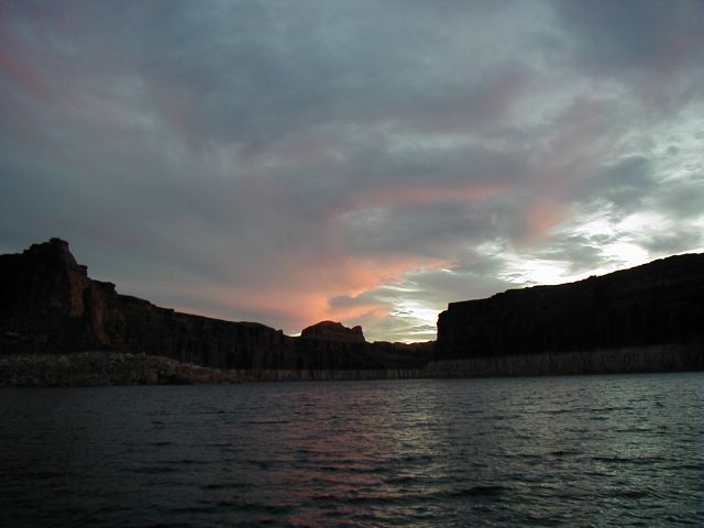
Beautiful sunsets!

Cocktail time on top deck!

Dinner

Painted Arachnis, one of the Tiger Moth family

Of the many arches on the map, this was the only one we saw.

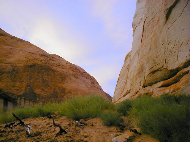
The side canyons were narrow. Sometimes rock was directly overhead.

A tight turn in a side canyon, watch that wall!

Almost every day there was a chance to hike.


Vegetation - sparse and prickly.
How to get thru the prickly bushes?

Another overnight mooring.

A fishing boat breaks the calm early morning water.

Which way does the channel go?

Another beautiful side canyon
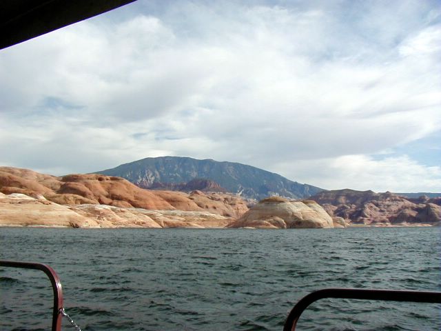
Navajo mountain, 50 miles away.

At this time of year you don't have to have neighbors

A swim and a shampoo (biodegradable, of course).
Sunset

Our farewell photo - Pat, me, Ann and John